
Tag: traffic
2012 @ 2400km
traffic quiz
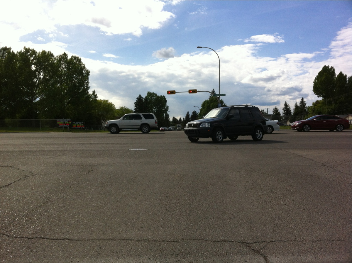
When driving in an active school zone, with school buses and kids in the area, you find yourself behind a cyclist. He is only going 35km/h in the marked 30km/h zone, and is riding in the middle of the lane (the other lane is for parking, and has cars and buses etc… along it). What do you do?
a) Realize that you are speeding, slow down to 30km/h, and continue as though nobody shat in your breakfast. Which is nice, because it’s a beautiful spring morning.
b) Honk. Swerve into oncoming traffic on this busy but narrow road. Accelerate to pass the cyclist. As you pass, roll down your window to exchange pleasantries with the cyclist.
In Calgary, the correct answer is b. It’s happened to me twice in just over 12 hours, and happens regularly.
2012 @ 1700km

mapping dangerous spots on a bike commute route
I just saw this amazing tool mentioned on BikeCalgary – an interactive map that lets you plot your bike commute route and then display bike-related incidents (I won’t call them accidents, because they’re not).
Turns out, my commuting route has only had 2 reported incidents in the last several years – both on a narrow stretch that causes me constant grief with drivers thinking they need to pass me even though it’s not safe to do so.

I had to fuss around with the map’s route plotting, because it doesn’t grok the pathway-road hybrid route. I don’t drive all wiggly like that, but I had to trick the map into getting the intersections I use…
Route mapping tools are available for Calgary, Vancouver, Toronto, Ottawa, Montreal and Halifax.
Update: I just realized there may be holes in the data – a friend of mine was hit while riding his bike at one of the major intersections on my route, but that doesn’t show up here. Not sure exactly where this data comes from – he was rushed to the hospital by ambulance, so there would be some record of the incident… (and his GPS tracker congratulated him on the record speed he got for his ride, as he was in the back of the ambulance…)
And, of course, these are just the reported incidents of injuries. There are several orders of magnitude more close calls that never get reported or recorded…
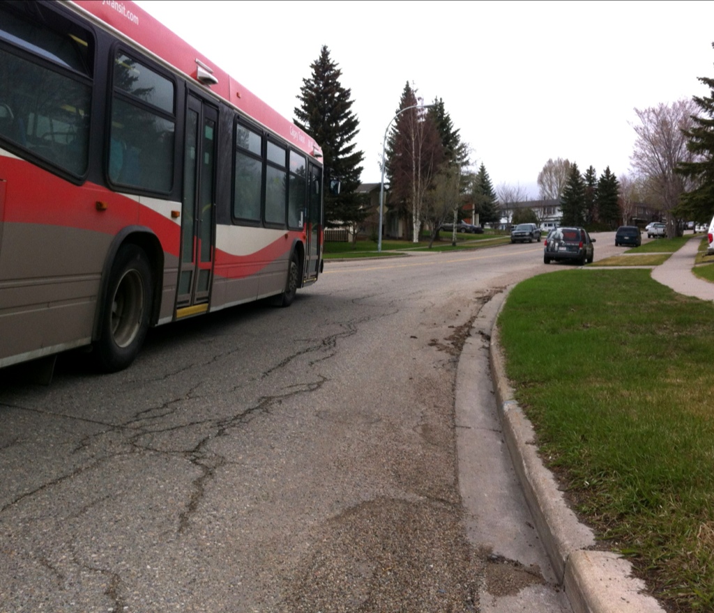
Update 2: Here’s a photo of that stretch of road. Doesn’t look dangerous, but it’s narrow, on a hill, with a corner at the bottom. Poor visibility, solid yellow line. Cars parked on both sides of the road. Often with big city buses coming in both directions as I come through here – they get to squeeze by. It’s a tight fit. Scary.
Calgary speed limit translation
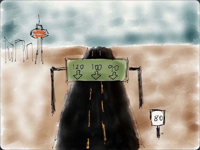
A public service, for those unfamiliar with the speed limit formula used in our city. The basic rule is:
- left lane: as fast as possible (general rule of thumb is speed limit + 50%)
- middle lane: speed limit + 25% or so (unless someone is in the left lane, then left lane formula applies)
- right lane: speed limit + 10% or so, unless someone is in either lane to the left, when left lane formula applies.
You are also encouraged to go as fast as needed in order to pass anyone smaller or less expensive than you. This is especially important in playground and school zones.
Last train

Hopefully the last train ride for awhile. To the bike!
back behind the wheel

Bureaucracy finally moved, and I was able to get my license renewed today, after several months without. Awesome. I’d rather be riding my bike, though… We’ve gotten used to being a single-car single-driver car, so we’ll likely leave the second vehicle parked in the garage, uninsured, until summer.
crowfoot

crossing crowchild trail, before heading down to the train platform. I am so ready for the roads to clear just a little bit more, so I can get back on the bike…
I was going to delete the photo, but decided the grain and blur captured my morning mood better than a sharp and saturated frame from my DSLR would have. ugh.
2066

the whole day felt a bit blurry and mindless.